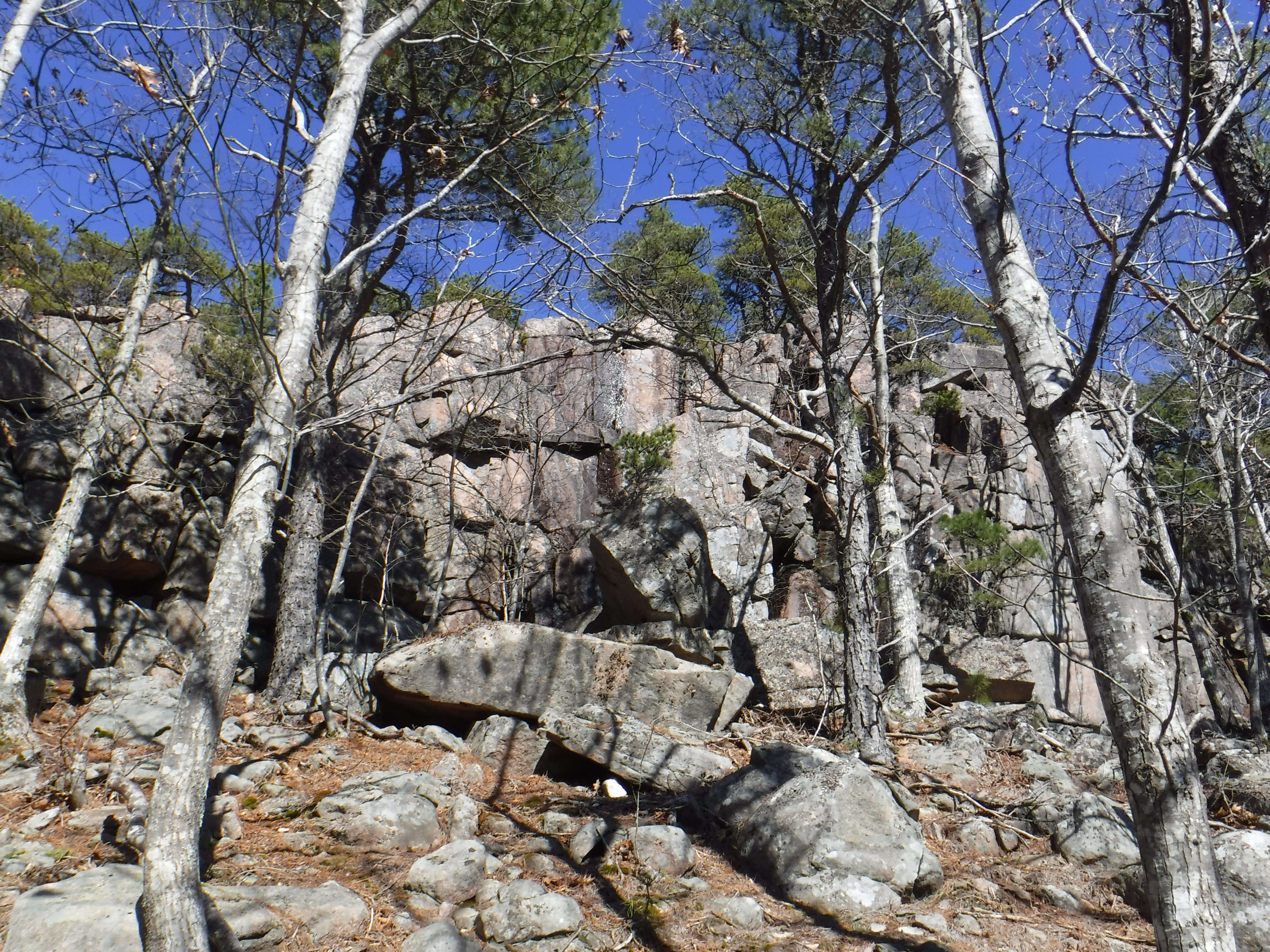
The snow's gone early and I needed a few pictures and gps tracks to finish up the new Summiting Acadia hiking guide so we set off to Mount Desert Island. Met a little construction along the way with some poorly signed re-routes but we eventually made it to our first stop of the day, a little peak once known as East Knob. There was some confusion in the maps of the area so I wanted to get clarification before completing my own map. Jaime came along with me as we parked at Compass Harbor and set out along the Schooner Road Path. I got my clarification on trails in the area and Jaime wanted to see the summit after just editing that chapter in the book. We bushwhacked our way up the short mountain, she did great. I slipped on some ice we didn't know was there on the summit ledges and got a little banged up but what's a day of hiking without out cuts and bruises?

Jaime sat the next one out as it involved a buttload of stairs, Dorr Mountain's Emery Path. I'd made note of a possible cascade along the trail but have only ever climbed it during dry conditions. From East Knob we could see a giant patch of ice and snow on the side of Dorr and I figured that had to be it. After way too many stone stairs I found out that indeed it was. Only problem, there was more ice than water and with the sun shining directly on it, the pictures were horrible. But it does exist so after a heavy rain, oh I'll be back.

Carefully making my way up the icy staircase I did not come prepared for, I reach the upper falls which were even more frozen over.

Not wanting to follow the icy staircase down the mountain, I opted for the nearby Homans Path. It wasn't much better, but at least there were no cliffs below me if I did go a sliding. I didn't, thanks to some nearby trees, but I did unintentionally skate down one section.

And then it was off to another little forgotten summit we'd been to before, Little Meadow Hill. I needed to doublecheck some facts about the view and get the gps tracks for the map. Jaime accompanied me again and we made our way up the Beachcroft Path which felt more like a stream. Without the leaves on the trees, the traiside cliffs of Little Meadow Hill were visible and looking quite magnificent.
We left the trail and followed a herd path to the summit, a path that wasn't there 10 years ago so I'm guessing people have followed my directions to the forgotten peak. Our goal was the specifics of the northern view today, got what we needed and moved on. The view during stick season is fine but autumn is when you really want to visit this hilltop.

I needed a few more gps tracks in the area so we continued through the woods to the Bear Brook Picnic Area, along the still closed for the season Park Loop Road. We scoured the woods looking for any remnants of the old Robin Hood Park horse racing track that once resided there but between the picnic area and Jackson Laboratory, there really aren't many traces of it left. We did find an old foundation in the woods nearby though, maybe once a concession stand or part of the former campground that also existed there after World War II.

We decided to do the George Dorr Bicycle Path loop around the beaver pond. The corner under the rockslide was a bit wet from spring runoff so our shoes got a little soggy but we made a chipmunk friend along the way. From the backside of the pond we could see the Emery Path falls I was at just a little earlier.

Jaime took a little break while I went a short ways up the Bear Brook just so I could see it with actual water in it. For years I scoffed at the idea of calling it a brook when it was clearly just a dry rocky sluice cutting down the mountainside. It was neat seeing it with water flowing for once, made crossing a little difficult though.

On our way back to the car Jaime's dad called to solidify plans for their trip down to North Carolina to visit her brother before he ships off overseas again. I decided not to go, someone has to stay here and take care of the cat, he'd die of depression if we were both gone for a whole week. Not to mention all of our outdoor critter friends who depend on us, especially this time of year when there's no food to be had. We have chipmunks, squirrels, skunks and a oppossum, and woodchucks but they're still sleeping in their holes right now. (Really wishing I'd left Maine, we had 3 snowstorms within 10 days while Jaime was gone, all close to a foot of snow, but hey I got a lot of work on the books done.) Jaime tapped out for the day and I made my way up The Bowl Trail so I could map Halfway Mountain's summit. Nothing to see from there but it does have a flagged unofficial path that didn't use to be there, so glad I checked it out before releasing the book. It's a nice little side trail to the peak.

With so much water on the trails I figured it'd be the perfect time to check out the Bowl Stream, one I've followed many times but never with much water in it. When I could hear it from over 0.1 mile away, I knew the brook would be raging, I'd never been able to hear it on any of my past visits. It did not disappoint. I'd seen the lower ledge falls with a siginifcant amount of water but the ones just below the pond always looked more like the stream of drool pouring from my mouth onto the pillow after a long day hiking. Finally, there was actual water in the falls. I was tempted to continue down to the lower falls but I was running short on sunlight and still had to make it up Gorham Mountain before dark.

Back to the trail and over to Gorham Mountain, rock hopping across a few wet patches and then dragging myself up the steep section just below the summit. Around that 10 mile mark my legs just stop wanting to move. But I needed some more photos from the summit because of all my previous trips up there, tell me why I only had pictures overlooking the ocean. Why? There is a spectacular view of Champlain Mountain and The Beehive, plus Dorr and Cadillac. I was beginning to question if I'd imagined the mountain view. I didn't, it's real. Look.

See? Told you it was real. I hurried down the mountain, the sun sets quickly in early March and I didn't bring a flashlight. Jaime had dropped me off at the trailhead and parked up the road at the Gorham Mtn lot to meet me, making my journey a little shorter, right about now I was grateful for any eliminated mileage. I thought I'd have to come back to get pictures of the memorial plaque at the start of the Cadillac Cliffs spur path but there was just enough sunlight left in the sunset to light up the shots.

Another minute later and I'd have been out of luck. I know it looks bright in the picture but that's just my camera messing with the lighting, this is what it looked like ten minutes earlier.

For the last few hundred feet I was barely able to see anything but luckily Jaime parked right in front of the trailhead and put on the highbeams for me. Had to be careful ont he rocky terrain, might have stepped in a puddle or two I couldn't see in the dark, but I made it bac to the car unscathed. Is it really a successful day of hiking if I don't come back to the car in the dark? Picked up some Burger King on the way home and had my first tomatoes, ketchup and bbq sauce in three months due to a spell of Chronic Idiopathic Urticaria (basically horrible hives from nearly all foods so I've been on a very strict diet that I'm just now starting to get off of). No hives after eating! Normally I'd be covered and my face would be puffing up so maybe hopefully I'm finally on the mend. Got enough info today to finish up the Summiting Acadia hiking guide. I could have used a few more pictures but daylight wasn't on my side. Great way to kick off the hiking season, even though I won't be able to move for the next few days. It's a good thing map mapping doesn't involve being on my feet.

https://www.amazon.com/dp/B0CYLJWYMM